Global Flood Risk Tool

Using the GFRT, you can conduct thorough flood risk assessments, with the option to create a set of customised solutions if the platform reveals a significant risk. And instant outputs offer flood risk reduction strategies specific to your needs. The output is generated instantly, for multiple scenarios, with large extents of up to 160 million grid cells, e.g. 20x20km at 5m resolution or 40x40km at 10m resolution.
GFRT also compares the costs of flood risk adaptation measures with the financial benefits of reduced risk, to build a strong business case for public and private sector decision making. You can also easily integrate the GFRT with other services, models, and tools.
The GFRT combines expert climate change and adaptation, flood risk, civil engineering, environmental economics, software development, data science, and machine learning expertise. And it’s trusted by leading international organisations, including port authorities, government real estate agencies, private industry, water authorities, financial institutes, and insurers.
The benefits of cloud-based flood risk analysis
Fast results
Inundation and damage calculations in just minutes rather than hours.
Accessible anytime, anywhere
Easy to use
Better decision making
Our five-step flood risk assessment
Using our five-step approach, the GFRT conducts thorough flood risk assessments to offer customised flood risk reduction strategies for your region, city, airport, or industrial site. And because each step is interlinked, you receive an updated assessment each time you change a variable.
Each step can also act independently, making the tool easy to use and enabling external data integrations, including:
- Detailed hydraulic model results
- Damage curve and exposure value database
- Cost databases
- Development and process scenarios
- Intelligent risk identification and adaptation
- Using the power of data science, artificial intelligence (AI), and machine learning, the GFRT automates a wide range of calculations, such as allocating damage functions, economic land values, and investment costs.
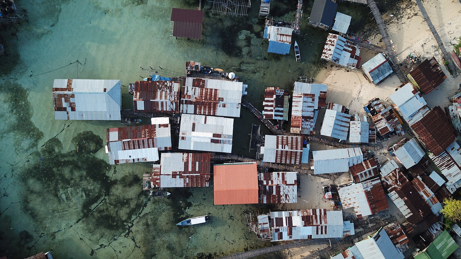
Intelligent features like AI and machine learning also help identify vulnerable assets through satellite image recognition. For example, in less developed areas lacking in geospatial information, manually adding missing data is costly and time consuming. By combining AI and cloud computing, the GFRT automates this process, generating quicker and more accurate results.
This can be particularly valuable for emergency aid organisations dealing with natural disasters, helping them create rapid damage assessments covering roads, rail, residential and public buildings, critical infrastructure, industrial sites, and more.
You can also use the GFRT to create a preferred flood resilience strategy, allowing you to generate emergency response plans for communities, ports, airports, or industrial sites.
Want to know more?
Want to know moreor got a question?
Contact our Climate Resilience experts!
Our offerings

 Climate resilience