Managing flood risk and reservoir safety at Havant Thicket
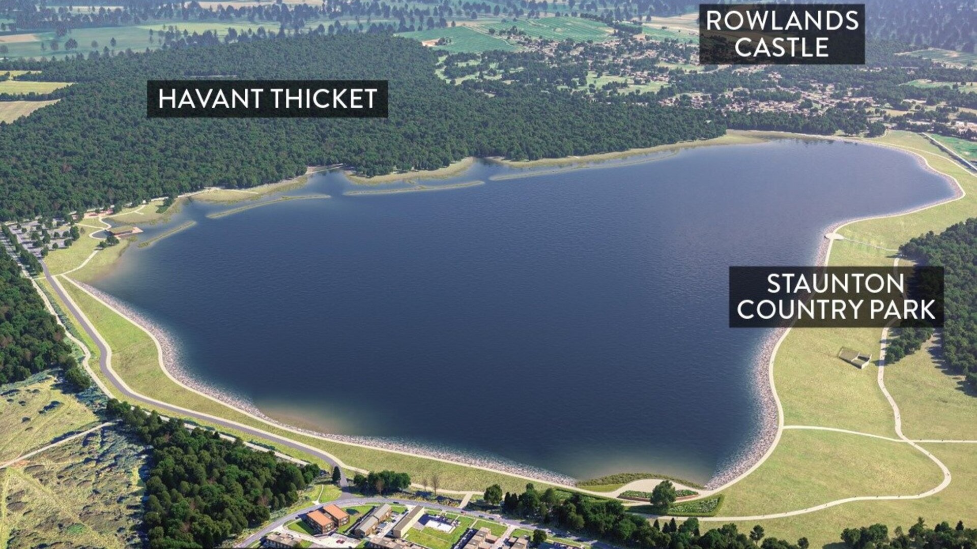
Havant Thicket Reservoir (Source: Portsmouth Water)
Project facts
- Client
- Future Water
- Location
- Hampshire, UK
- Date
- 2025
- Challenge
- Assess flood risks for complex, clay catchment under varied scenarios, including extreme climate change and potential reservoir breach events.
- Solution
- Built detailed 1D-2D hydraulic model, modelling all design, breach, and construction phase scenarios.
The challenge
The proposed Havant Thicket Reservoir, located north of Havant, is a major infrastructure project designed to enhance regional water supply resilience. In order to deliver the proposed reservoir safely, it was necessary to understand any flood risk implications. Accordingly, the Environment Agency required a robust hydraulic modelling study to assess baseline flood conditions and the impact of the proposed reservoir embankment under various scenarios.
Key challenges included:
- Complex catchment: The relatively small catchment is underlain by clay and includes multiple watercourses, which results in responsive runoff characteristics.
- Scenario diversity: Modelling needed to cover baseline, temporary construction phases, reservoir design conditions (with and without the spillway), as well as sensitivity testing the unlikely event of a reservoir breach.
- Climate change: Upper-end climate change allowances were applied to ensure conservative risk assessments.
The solution
Haskoning developed a high-resolution 1D-2D linked ESTRY-TUFLOW hydraulic model, incorporating:
- LiDAR-derived Digital Terrain Models (1m resolution) for accurate topographical representation.
- Direct rainfall modelling using FEH13 and ReFH2.3 methodologies to simulate multiple storm durations.
- Comparable scenarios covering baseline, temporary construction phases, reservoir design conditions (based on Section 73 documents, including spillway details), and breach conditions.
- Sensitivity tests included variations in surface roughness, inflow, and downstream boundary conditions.
Three primary embankment scenarios were modelled:
- Without spillway – assessing the total reservoir capacity.
- With spillway – evaluating downstream flood risk from controlled outflow via the spillway culvert.
- With breach – simulating the failure of the embankment during a storm (0.1% AEP Wet Day Embankment Breach).
The outcome
The study delivered critical insights:
- Reservoir performance: The embankment design provides sufficient storage for the 1 in 100-year storm without requiring the spillway.
- Downstream risk reduction: The spillway scenario showed a 91–94% reduction in downstream peak flows (relative to baseline), significantly mitigating flood risk.
- Breach impact: While a breach scenario resulted in significant downstream flooding, the affected areas were largely open, riparian land, with minimal risk to property.
This work supports the planning of the Havant Thicket Reservoir, achieving water supply and flood risk management objectives.
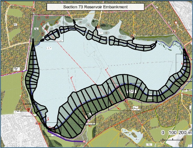
S73 Reservoir embankment representation (Source: Haskoning)
Want to know moreor got a question?
Contact our Climate Resilience experts!