Spatial opportunities for Friesland from the Lely line
.png?h=1080&iar=0&w=1920&hash=8f59379655337528ea3909ce44d6357d)
Project facts
- Client
- Municipalities of Smallingerland and Heerenveen
- Location
- Drachten and Heerenveen, the Netherlands
- Date
- June – September 2023
- Challenge
- Provide insight into the spatial impact of the Lely line on the municipalities.
- Solution
- Spatial visualisations for potential scenarios for the cities and surrounding areas with the Lely line
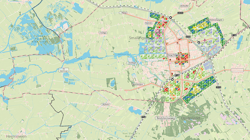
The challenge: Identifying opportunities created by the Lely line
The Lely line is the proposed railway connection between the northern Netherlands and the country’s largest urban region, the Randstad. But what would this new connection mean for land use and spatial planning? How would it impact the interaction with housing plans and urbanisation around mobility hubs? And does it contribute to comprehensive societal well-being?
These questions were posed to Haskoning by the municipalities of Heerenveen and Smallingerland (Drachten) which will host two of the main station stops.
The solution: Scenario testing
The reinforcement of infrastructure through the Lely line will be a guiding factor for both municipalities. It will support economic opportunities, housing, and the wider development plans for both urban and rural areas.
Both municipalities currently have fewer than 50,000 inhabitants. And Drachten is the largest town in the Netherlands without a railway connection, making a station essential for its future development.
If the new railway line is constructed they each want to build an additional 10,000 homes, this is more than existing plans.
Haskoning examined the potential and possible development opportunities in parallel with analyses of the economic impact on both municipalities.
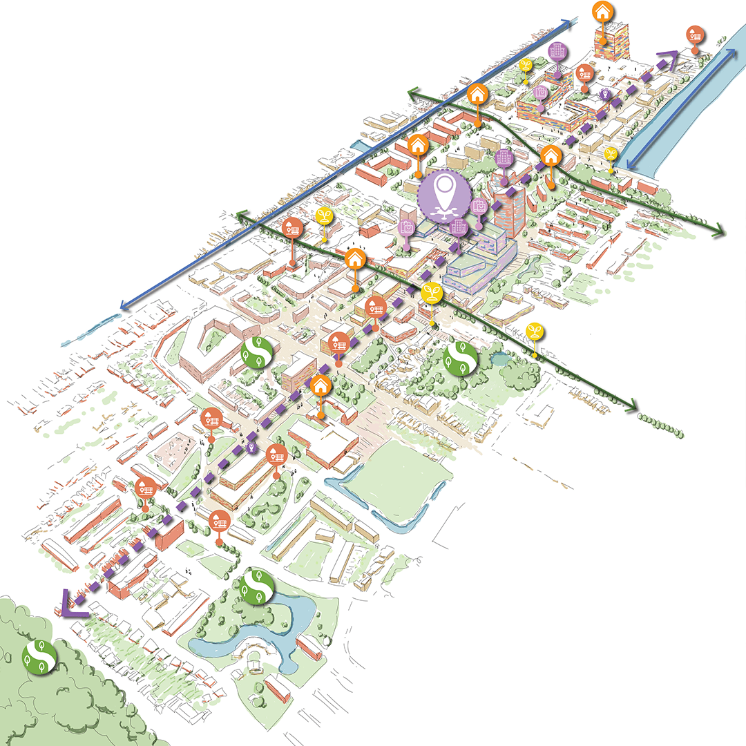
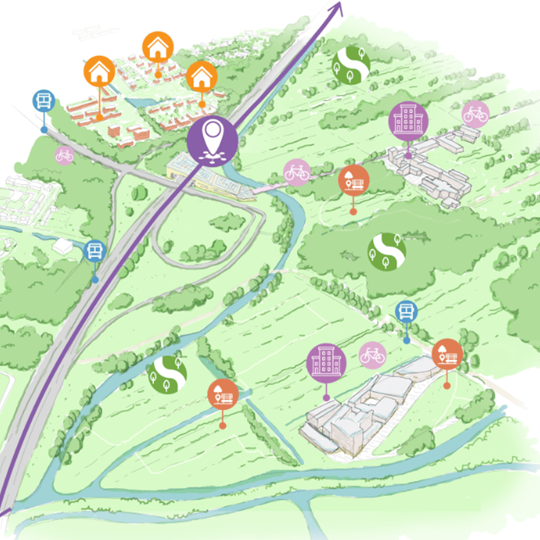
We developed three scenarios, ranging from focusing on the main urban centres with maximum densification, to strengthening smaller villages instead.
Each scenario has specific implications for:
- the optimal locations for stations
- housing development
- business activity
The spatial–technical implications were made accessible through clear visualisation.
The municipalities of Smallingerland and Heerenveen want to stay in control of their spatial quality when the Lely line arrives. With our combined expertise, we were able to deliver a visionary and realistic contribution.
The result: Maintaining control of the spatial agenda
Haskoning developed a foundation that allowed the municipalities of Smallingerland and Heerenveen to engage in the next Multiyear Programme for Infrastructure and Spatial Planning (MIRT) discussions with the national government and other Lely line stakeholders.
The exploration provides useable insights on the spatial and strategic agenda. Helping the municipalities create:
- responsible urban quality around mobility hubs
- respect for the value of the rural landscape
- optimal benefit from the Lely line
- attention to broad prosperity
Mobilityenquiries
Contact our Mobility experts