Preparing Foodvalley for 40,000 new homes
Project facts
- Client
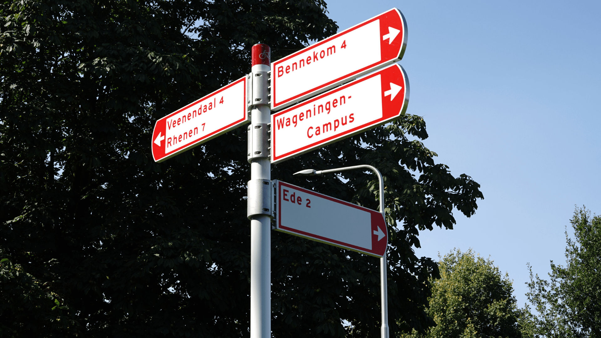
- The Foodvalley region
- Location
- Gelderse Vallei (provinces of Utrecht & Gelderland)
- Date
- 2024–present (model delivered in 2025, now in the implementation phase)
- Challenge
- A shared mobility model to support housing developers and regional decision-makers.
- Solution
- Multimodal tour-based transportation model and web-based self-service viewer.
About Foodvalley
Regio Foodvalley is a collaborative partnership of eight municipalities in the Gelderse Vallei, including Ede, Veenendaal, Wageningen and Barneveld. In total 350,000 inhabitants live in the region. The collaboration attracts knowledge institutions and businesses in the agrifood sector, and governments, who work closely together on sustainable growth and a futureproof food system.
The challenge – improving accessibility for 40,000 new homes
Across the municipalities that make up the Regio Foodvalley there is a need for approximately 40,000 new homes. Historically, each municipality used its own transportation model, leading to inconsistencies, fragmented insights, and debates about mobility issues.
Due to strong interdependencies such as the Veenendaal municipality having limited room for expansion, there was a clear need for a single, shared, reliable and multimodal transport model to act as a foundation for spatial planning decisions, mobility and infrastructure investments.
The solution – a multimodal, future proof transport model for the entire region
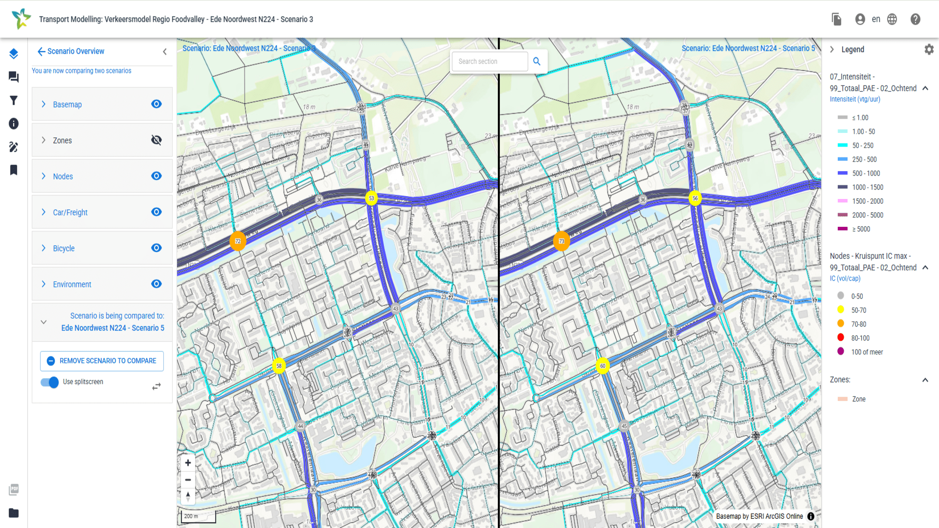
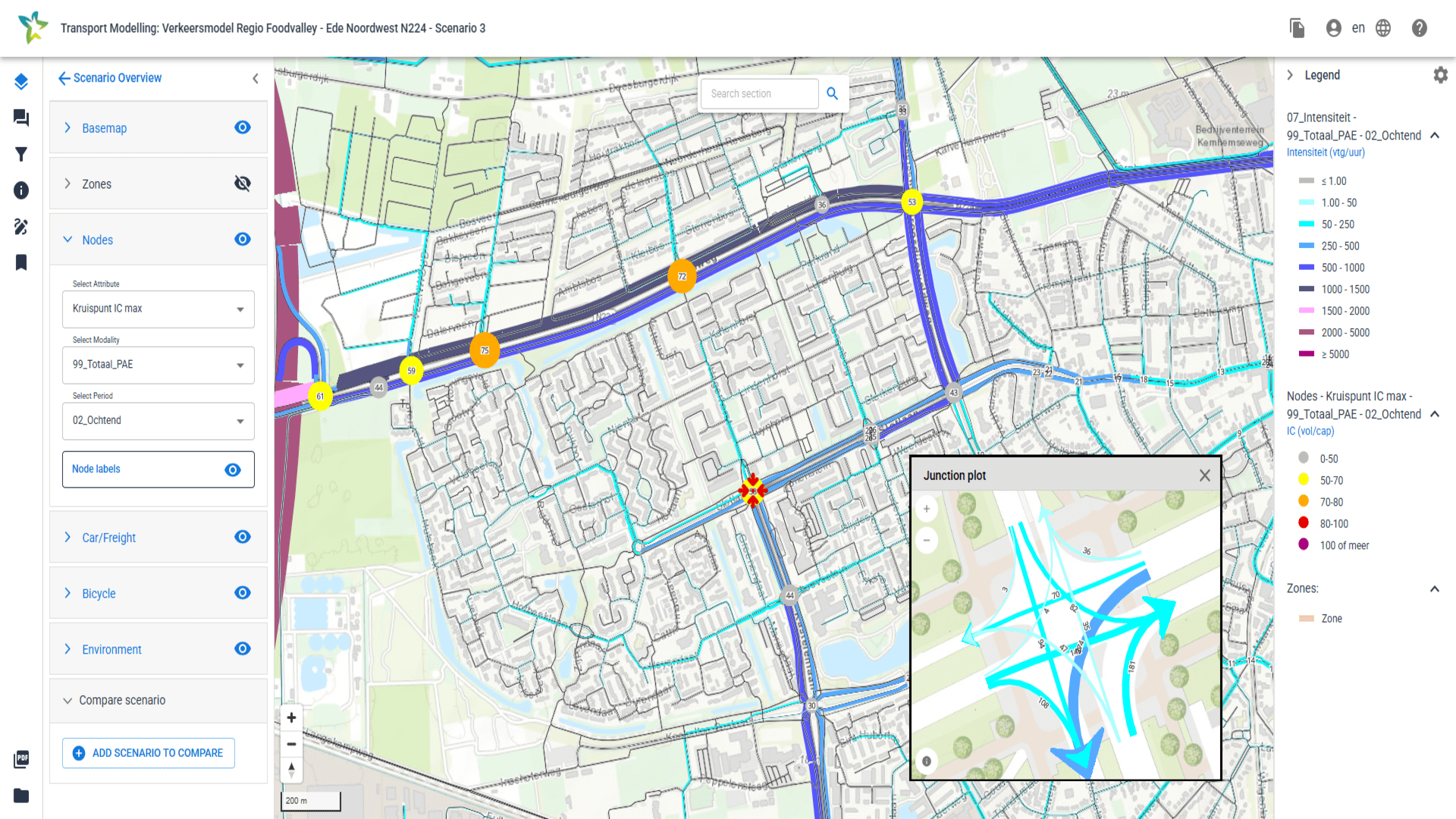
Haskoning was commissioned to develop a tour-based and multimodal (macro) transport model for the entire region. This will evaluate travel demand by considering whole daily journeys that start and end at the same place, showing how people use different types of transport throughout a day. The model calculates both current demand and traffic flows and future scenarios, including developments in housing, business, infrastructure. It also accounts for the changing cost of cars, public transport and, for example, trends such as working from home.
In addition to traditional factors included in models, the tour-based model can provide insight into the effects of mobility transitions, parking, hubs, park and ride (P+R), and environmental zones because it allows for journey chains and transfers between modes of transport and uses a disaggregate methodology in the choice models.
The model is built using Aimsun software, which makes it easy to switch to mesoscopic assignment techniques or even microsimulations within the same project. It also offers a tailored web-based viewer which municipalities can use to perform simple analyses themselves and even model their own interventions.
Overview of different traffic models for the Foodvalley region
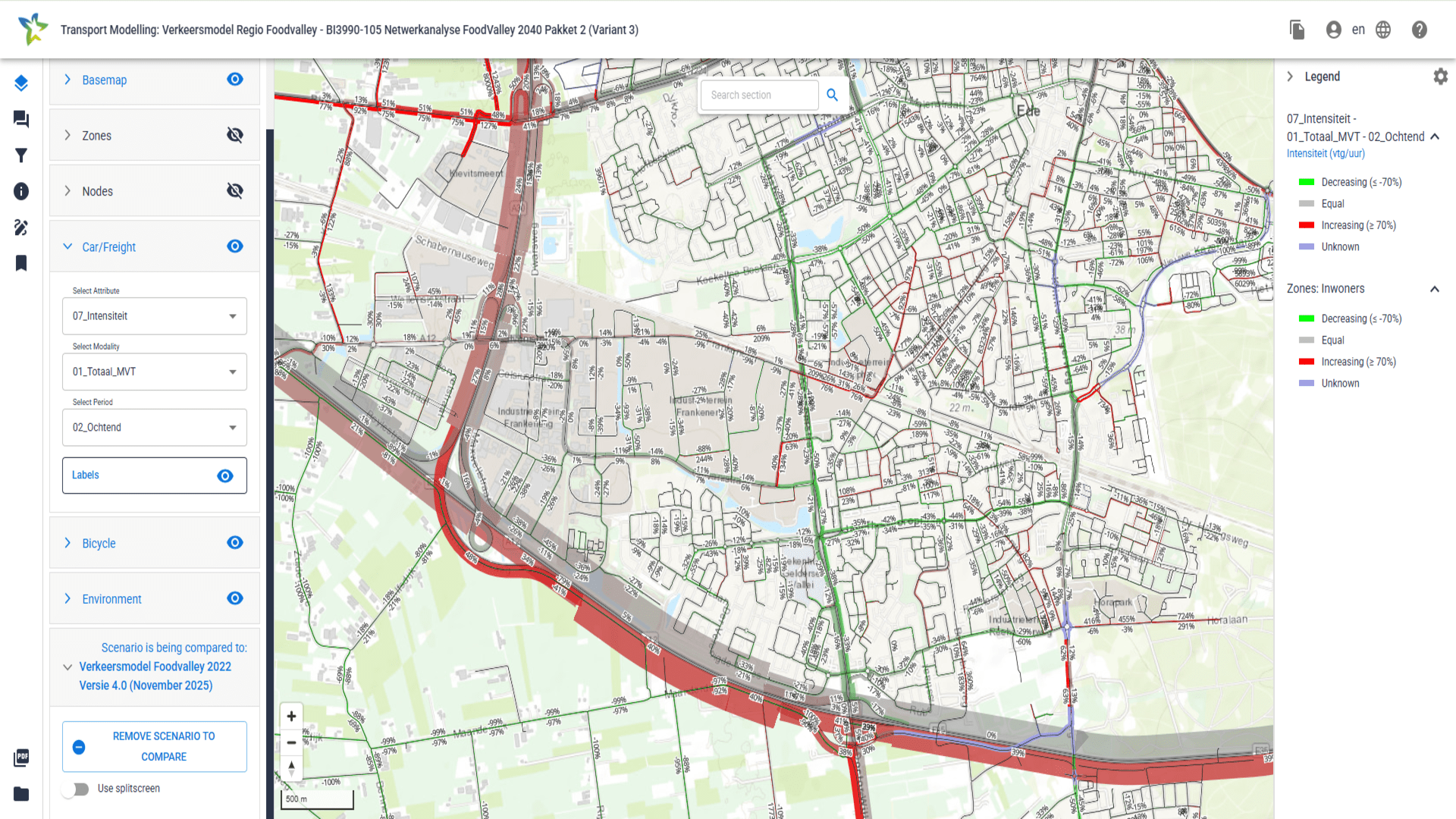
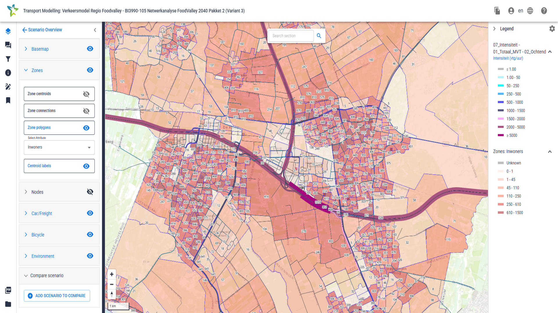
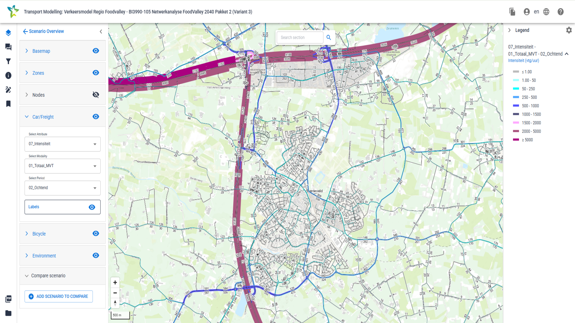
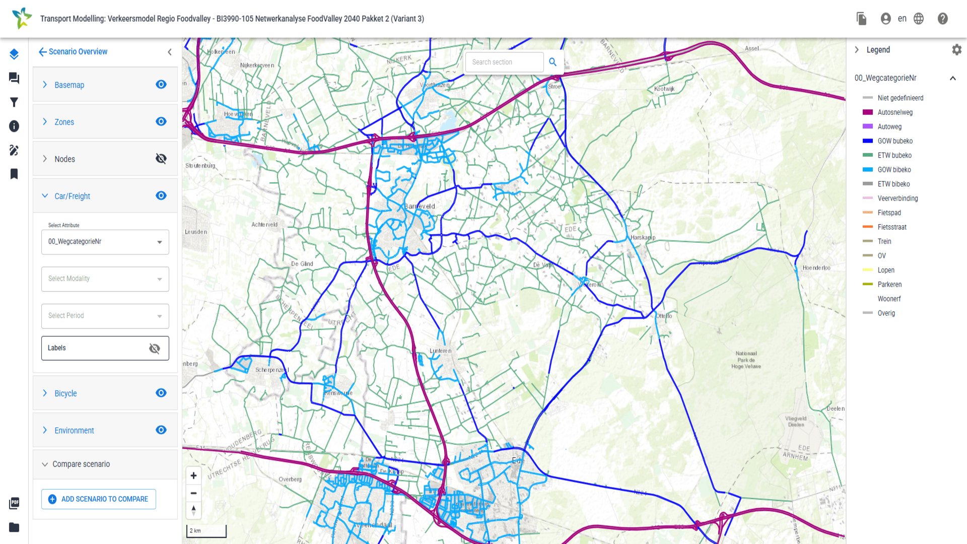
With one traffic model for the entire region, we are helping Foodvalley make faster, smarter and more consistent decisions about mobility and housing.
The result for the region
With the shared transport model, the Foodvalley municipalities have, for the first time, a single source of truth for substantiating mobility and spatial planning decisions. The model has already been applied to, among others, the Wageningen mobility program, the “Het Ambacht” residential development in Veenendaal (approximately 1,500 homes), area visions such as “Voorthuizen Oost”, and traffic management related to the closure of the A30 highway.
As a result, municipalities gain better control of their growth and can bring planning applications for new developments forward more quickly and with stronger substantiation. Furthermore, the model provides better insight into how housing development can be further scaled-up by identifying optimal transport investments to connect proposed developments.
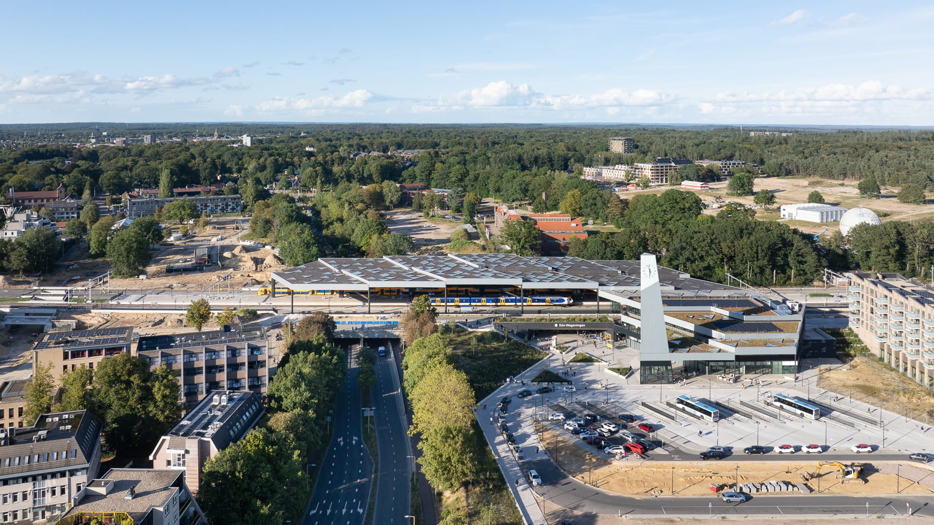
Transport model helps shape new transport hub Ede-Wageningen
Ede Wageningen is a tangible example within the Foodvalley region where accessibility and housing value are developed in relation to one another. By investing in a high quality public transport hub, including a redeveloped station, bus plaza, park and ride P+R facilities and large scale bicycle parking, a future proof mobility solution has been delivered that directly enhances the attractiveness of the region.
Mobilityenquiries
Contact our Mobility experts