Hydraulic modelling to enhance resilience at Titchwell Marsh
Project facts
- Client
- Royal Society for the Protection of Birds (RSPB)
- Location
- Norfolk, UK
- Date
- 2023
- Challenge
- Increasing tidal erosion, habitat vulnerability, lack of real-time data to understand evolving flow dynamics
- Solution
- Building a hydraulic model, to assess erosion risks and validate flow patterns for informed planning
The challenge
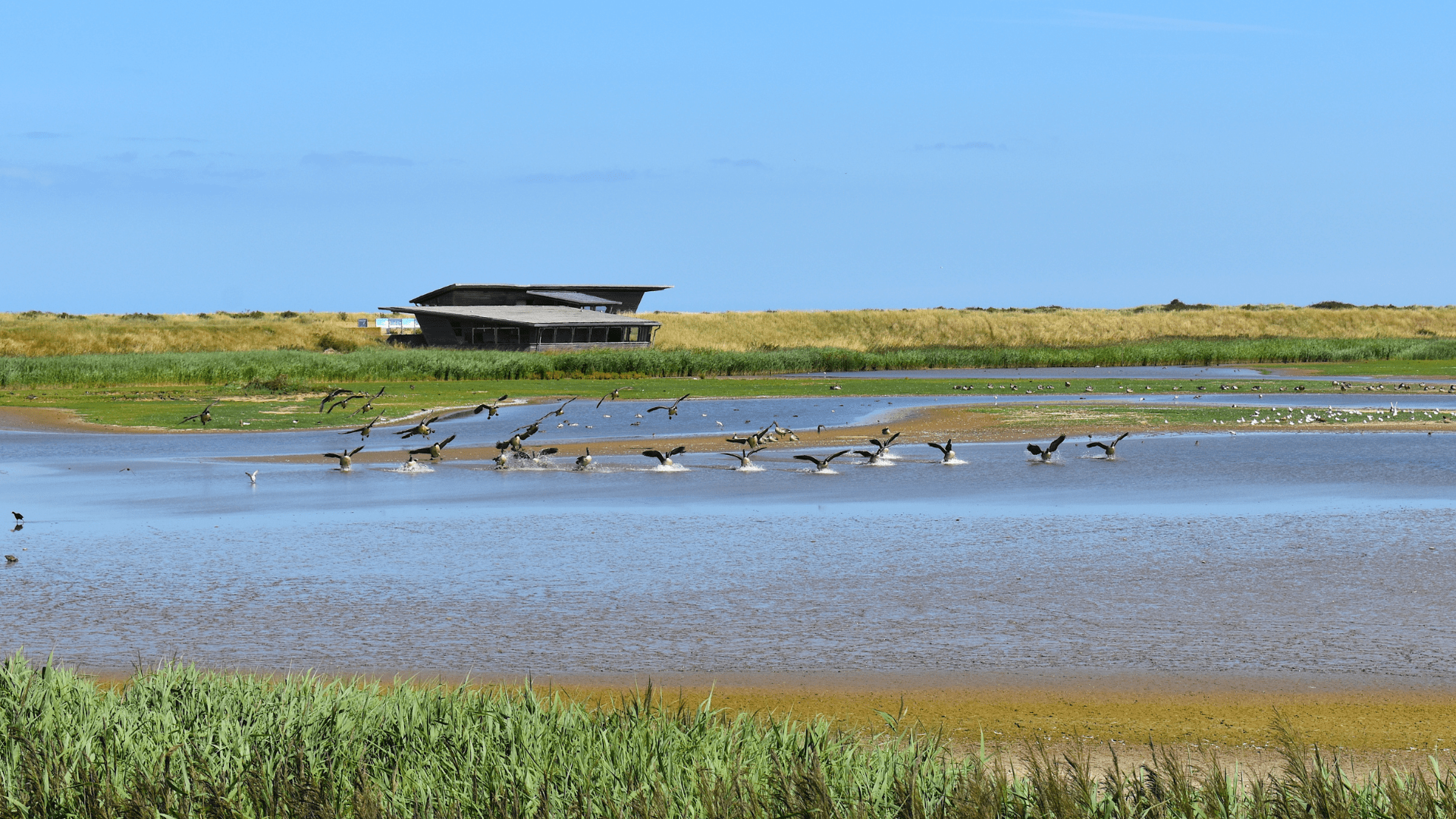
Titchwell Marsh, a vital coastal wetland on the Norfolk coast, is internationally recognised for its ecological importance, particularly as a habitat for migratory birds. The site is increasingly threatened by tidal erosion, particularly around the Volunteer Marsh and Parrinder Bank, where an engineered breach in the embankment has altered tidal flow patterns.
Key concerns included:
- Erosion Risk: Accelerated tidal flows were contributing to erosion of the Parrinder Bank and widening of the breach in the Volunteer Marsh.
- Habitat Protection: The freshwater lagoon and surrounding marshes are critical for biodiversity and require careful hydrodynamic management.
- Data Gaps: Limited real-time measurement data necessitated a robust modelling approach to understand flow dynamics.
The solution
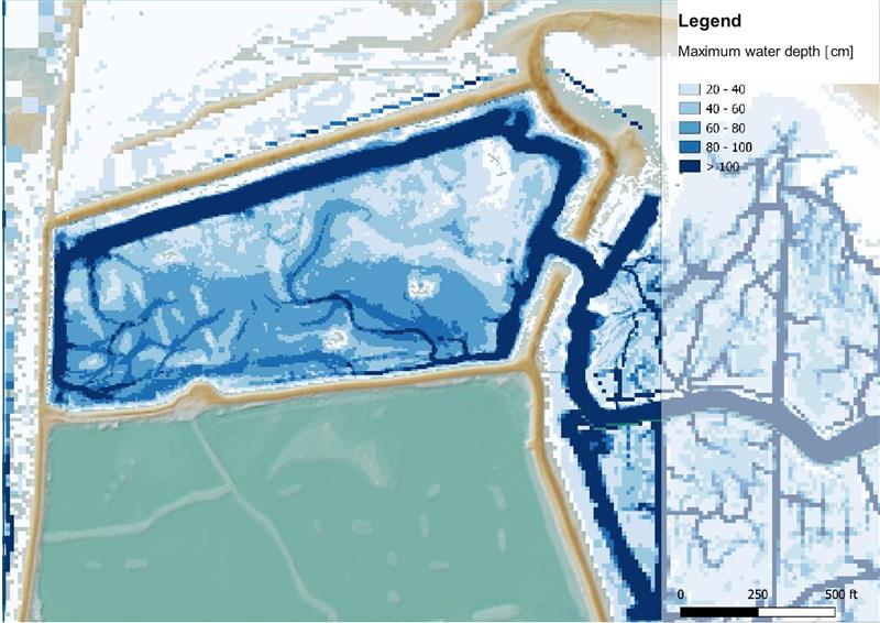
Haskoning developed a high-resolution 2D hydraulic model using the 3Di modelling platform, focusing on simulating tidal flow behaviour under three distinct scenarios:
- Scenario A: A typical high tide event.
- Scenario B: An elevated tidal wave (T1).
- Scenario C: The December 2013 storm surge, one of the most severe in recent history.
The model incorporated:
- LiDAR-derived Digital Terrain Models (1m² resolution) for accurate topography.
- Dynamic friction mapping based on land-use and topographic elevation.
- Sub-grid modelling to capture fine-scale flow dynamics within a computationally efficient framework.
A sensitivity analysis was conducted to test the impact of varying bed friction values, and video-based validation using RSPB field observations helped confirm model accuracy. Model result animations were presented to the client team, enabling them to sense check the model and improve confidence.
The entire team excelled in several aspects of the project. Most importantly, their reliability and insight built a huge sense of trust, allowing us to confidently rely on them to guide us toward the best solutions.
The result
The modelling exercise delivered several key insights:
- Flow Dynamics: High flow velocities were observed during both flood and ebb tides, with the ebb phase producing longer durations of high velocities—particularly along the southeast corner of the Volunteer Marsh, aligning with observed erosion hotspots.
- Risk Zones Identified: The model pinpointed areas of sustained high flow velocity, informing future erosion mitigation strategies.
- Validated Approach: Despite limited empirical data, the model was validated through visual comparison with field video footage, confirming its reliability.
This baseline model now serves as a foundation for Stage 2 of the project, where potential intervention and management options will be explored to protect the marsh’s ecological integrity and enhance coastal resilience.
Want to know moreor got a question?
Contact our Climate Resilience experts!